
The Lecrin Valley area undoubtedly occupies a privileged location, situated between the Genil Depression and the Mediterranean coastline, making it an almost obligatory stage of the route between Granada, the Alpujarras and the Mediterranean coast. Furthermore, any visitor to our Valley will be enchanted by its beautiful landscape of orange, lemon, olive and almond groves, irrigated by a system of irrigation channels that are a legacy of our Moorish past. The area also offers a wide variety of contrasting landscapes, changing over a short distance from the high mountain scenery of the Sierra Nevada to the altogether distinct tropical scenery of the Granada coastline between La Herradura and Salobreña.
At the same time, it is also an area where on many occasions time seems to stand still, where the new millennium has not yet arrived, where there are villages that preserve the medieval-Moorish past in their steep, narrow alleys where loaded mules can still be seen passing by.
The Lecrin Valley is situated on the south-western slopes of Sierra Nevada, which forms its eastern edge and is the door onto the Sierra Nevada National Natural Park. Its western edge is formed by the gentle hills that end with the Albuñuelas plateau and its southern edge is formed by the Lújar and Guájares mountains. It is precisely this geographical layout that gives our area such beautiful scenery, since the mountain wall formed by the Sierra Nevada shelters us from the cold northerly winds and creates a microclimate ideal for the cultivation of citrus fruits.
Our valley forms part of the Penibetic Cordillera and its geomorphologic development was linked to this mountain range. During the Tertiary Period (which began 65 million years ago and ended 2 million years ago) and as a consequence of post-orogenic movements, the cordillera was broken up by a series of fractures and faults which included a series of tectonic trenches, the Lecrin Valley being situated in one of them. The trench unit, however, was broken up by a rocky spur that separates the Lecrin Valley itself from the Albuñuelas plateau. Later on, the major erosion and sedimentation that the area experienced wore down the highest areas and slowly gave rise to the formation of erosion platforms, such as can be seen on the Albuñuelas plateau, whilst at the same time filling in the depression. As a result, the Lecrin tectonic trench and the Albuñuelas depression are quite distinct. The separation of the two is largely marked by faults, the largest of them in terms of continuity and clearness being the El Padul-Dúrcal-Nigüelas fault, which in turn separates Sierra Nevada from the Lecrin depression.
Throughout the Pliocene and Quaternary Periods (which cover the last 2 million years), all of these morphologic units underwent a series of changes mainly due to climate change and subsoil instability. The combined effect of these two elements of change was the appearance of a series of “lesser” units of vital importance since, due to the different altitudes and exposures produced, they affected the climate and brought about differences that man was then able to make use of to create distinct types of rural landscapes and ways of life, all contrasting with each other and with the rest of the province.
By laying down major sedimentary layers at their exit from the mountains through which they then cut their channels to form today’s valleys, the Rivers Dúrcal and Torrente broke down the trench into a series of lesser units which are studied below.

The materials laid down by the River Dúrcal at its exit from the Betic Massif separated the El Padul depression from the rest of the Lecrin Valley. It is an oval, completely enclosed depression. In it grew lacustrine vegetation, the remains of which, along with the organic animal and vegetable matter brought from surrounding regions through the ravines, produced a large accumulation of organic material that was covered by a layer of mineral talus and underwent an incomplete carbonisation process to form enormous peat deposits, which are what made the El Padul plains so fertile.
The source of the El Padul or Laguna River is in the centre of the depression, in a source of karstic origin called the “Ojo Oscuro”, the Dark Eye. This source flows strongly all year round, although levels drop in the summer. The river flows through the entire depression, being fed by dams and drainage channels until finally reaching its outlet and flowing into the River Dúrcal. This exit point is very recent and man-made - in the 19th century the lake was drained, since until then there was no natural outlet for the water and the area was boggy, unhealthy and a source of malaria or paludism, namesake of the town we know today as El Padul.

The source of the River Dúrcal is in the heart of the Sierra Nevada at almost three thousand metres, flowing down through a wide valley with sheer walls of astounding beauty, until arriving at the fault that forms the edge of this part of the valley. It reaches the edges of El Padul and Cozvíjar, then flows into Cónchar where it cuts the dolomites of the Albuñuelas spur. The river meanders through this valley in a series of bayonet curves with sharp angles. In Murchas the valley begins to widen until reaching the Melegís depression, formed by the Rivers Dúrcal, Torrente and Albuñuelas together, which then join to form the River Ízbor.

Like the River Dúrcal, this river’s source is in the heart of the Sierra Nevada and it flows through a valley running parallel to the River Dúrcal. Its valley remains incised until it reaches the El Padul-Dúrcal-Nigüelas fault. On leaving the fault zone, and due to the low resistance of the materials it flows through, its erosive capacity increases and the valley gets bigger, until in finally joins the River Dúrcal in Melegís.
As the Rivers Dúrcal and Torrente are incised where they come out of the mountains, each one has constructed it own valley at the cost of block formation, this remaining high out of the reach of erosion, an independent valley being formed. This is a wide, very shallow valley bordered by the El Padul-Dúrcal-Nigüelas fault, whilst its ends open towards the valleys of the Rivers Dúrcal and Torrente.

At the confluence of the Rivers Dúrcal, Torrente and Albuñuelas, there is a wide depression, considered to be the heart of the Lecrin Valley. A series of different factors must have had an influence on its formation: firstly, being the point of confluence of the three rivers; secondly, being a settlement area where the faults that mark the boundaries of the Lecrin Valley and the Albuñuelas depression cross each other; and thirdly, the formation of a local base level in this area which attracted the different rivers, and of a lacustrine area during the time that drainage of the entire area was made difficult due to the rocky threshold that linked Sierra Nevada and the Guájares mountains and hindered the passage of the Ízbor river until it was able to make an opening. In this area three terrace systems can be seen, in addition to the current rivers.

After the Melegís depression, the Rivers Torrente, Dúrcal and Albuñuelas joined together to become the Ízbor River, whose valley becomes progressively more incised and narrow, forging its way through a narrow gorge to leave the Lecrin Valley. Once it has left the Valley, the Lanjarón River runs into it and then it feeds into the River Guadalfeo.
This is another tectonic trench, similar to the Lecrin Valley one, which it joins near Restábal. The River Albuñuelas has used it to form its valley. This river has its source in the Albuñuelas plateau, initially forming a ravine which joins various other watercourses until finally becoming the river, which is also called the River Saleres or the River Santo. Framed in the plateau, it forms a narrow valley less rugged than the mountain valleys of the Dúrcal and Torrente rivers. After passing through Saleres it joins the River Dúrcal in Restábal and then joins the River Torrente.
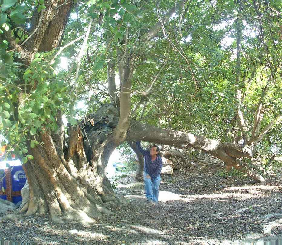
The Lecrin Valley falls within the Sierra Nevada bioclimatic area. The fact that its climate is strongly Mediterranean and not affected by the Atlantic is a fundamental factor explaining the type of vegetation found in the area. Most of the natural vegetation is found limited to the mountain slopes, where there are still some isolated examples of trees or small woods. These are generally sclerophyllous trees with woody trunks hardened by a thick layer to prevent water loss, and which stay green all year round due to their small leaves and hardened cuticle to prevent transpiration and thus protect themselves from the dryness of the environment.
Our area has suffered major deforestation due to man’s tireless search for agricultural land and obtaining wood and firewood for his needs, or indirectly due to grazing activities which were more damaging to vegetation given that goats were the principal livestock raised in the area. On other occasions the area has been devastated by fires and, in view of this and of the dangers of deforestation, soil erosion and desertification, a major tree replanting operation has begun, using a mix of spontaneous climax species and anthropogenic species which have created a mixed vegetation, although scrub always predominates over woods.
The principal element today is the Holm oak, which grows all over the area up to altitudes of 1800 metres, and other trees of the same family such as the dwarf evergreen oak and shrubs, although they do not form true forests. Sharing the level of the Holm oak and even down to 500 metres altitude we find the Aleppo pine (pinus halepensis) which, with the Holm oak, is the most characteristic tree of the area. Then, sharing the lower edge of the Holm oak level, we find different types of chestnut trees (which in reality are anthropogenic trees, although they have existed since Roman times). Around them a sub-serial scrub has appeared, made up of small woody and aromatic plants such as: broom, Spanish broom, thyme, rosemary, esparto grass and gorse.
On the same level as the Holm oak we also find other trees of the Quercus family, although less widespread, such as cork oak, Pyrenean oak and beech oak. The undergrowth in this area contains peonies, common sage, lavender and lilies.
Above the level of the Holm oak and up to 2600 metres we find the larch pine, Austrian pine and Sylvester pine. Here the undergrowth is made up of bupleurum, chickweed, species of broom and astragalus.
The alpine level begins at 2400-2600 metres and is where we find savine and dwarf thistle, bupleurum, broom, Tor grass.
At the bottom of the valleys and along the river banks we find poplar, alder, birch, ash, holly, black poplars, willow and elm trees.
In the depressions and valleys of the high Sierra Nevada, there are meadows irrigated by the snow melt.
As regards anthropogenic vegetation, and as we mentioned before, it has been planted to stop the soil erosion and desertification processes caused by man’s farming and livestock grazing activities. The species first planted for reforestation purposes were Aleppo pine and eucalyptus at the lower levels. These were spontaneous species. Among the new species introduced are various types of pine such as Ponderosa, Monterrey and mountain pine on higher levels. Other species used for successive replanting operations are Aleppo pines.

Up until the 1970s, the area’s economy was totally dependent on agriculture, livestock farming and secondary rural activities, which have left a visible mark on the landscape of the area. Three zones can be observed, their differences the result of the physical layout of the ground and climate conditions particular to each. There are the mountain slopes that border the valley, where the lack of farming land and extreme temperatures only permit mountain farming. Another area is formed by the platforms at the foot of these mountain slopes, at an altitude of over 600 metres, where the crops cultivated have adjusted relatively well to the cold, and where the presence of a large number of springs allows us to differentiate between irrigation agriculture and dry farming. Lastly, in the lower areas and the river valleys where temperatures are higher and freezing practically never occurs, are the plants that require a degree of heat such as citrus fruits, which lend the Valley its signature beauty.
The villages of Cozvíjar, Melegís and Murchas, located in the depression, have a higher proportion of cultivated area. Chite, Talará, El Padul and Restábal, although also in the depression, are nearer the mountains; whilst Acequias, Béznar, Cónchar, Ízbor, Lanjarón and Pinos del Valle are evidently mountain areas, Albuñuelas being the clearest example.
There is a clear difference between irrigation and rainfall farming. All the municipalities give over a significant part of their area to irrigation farming. The irrigation system is very old, going back at least to the time of Muslim Spain with the water distribution systems and network of irrigation channels created by the Moors. These acequias or irrigation systems were kept by the Christians when the land confiscated from the Moors after their uprising and expulsion under Philip II was redistributed. In Lanjarón, Melegís, Cozvíjar, Chite, Talará and Béznar, over 50% of the land is irrigated, mainly due to the location of these villages in the depression which gives rise to abundant water supply, crossed as they are by rivers (River Lanjarón crossing Lanjarón; Rivers Dúrcal, Saleres and Torrente crossing Melegís). Other towns and villages such as Dúrcal, El Padul, Mondújar, Murchas, Nigüelas and Pinos del Valle do not have such a high percentage of irrigated area, the figure being around 30-50%; whilst in the remaining villages Cónchar, Albuñuelas, Ízbor and Saleres, the percentage is lower still. The smaller area of irrigation is because the land layout does not favour it either because it is high up, or soil quality is poor, or because water resources are scarce.
The areas of Melegís, Restábal, Talará, Béznar and Chite merit particular mention since, as well as being in the heart of the Lecrin Valley in the centre of the depression and having abundant water resources, they are also naturally sheltered from northerly winds and thus have far milder winters with practically no freezing. This makes them an ideal zone for citrus fruit cultivation, which is the main source of income in the area not just through the sale of crops but also because of the resulting prettiness of the landscape, which attracts a growing number of visitors.
As we commented before, water for irrigation purposes is obtained mainly from the natural water resources available around the Rivers Dúrcal, Torrente, Saleres and Ízbor; and from the abundant springs found all across the area. An example of this is the El Padul area, where there are more then thirty springs, the largest being the “Ojo Oscuro”.
As regards dry farming, it is also significant. In some villages it accounts for over 80% of the cultivated area. Most abundant are olive and almond groves, which are highly adaptable to extreme conditions, and to a lesser extent vine cultivation (relatively significant in the area between Cónchar and Cozvíjar, where there is a famous winery).

Houses are a fundamental part of the rural landscape, and their roofs, building materials, structure and types of room reveal the influence of the climate and lithology of the surrounding area. At the same time, they reflect the socio-economic sphere, being a work instrument for the farming and livestock activities of man, as well as his dwelling place.
The oldest houses were constructed using naturally occurring cheap materials such as stone, abundant in all the surrounding mountain areas, and clays found in the depression. Clays were used to give shape to the stones and to hold them together. Also used as a binding material was a mixture of rich lime and sand, which was stronger and longer lasting. Later on, solid brick was used, made in the villages themselves using a suitable type of clay, and cement being used as the binding material. New construction techniques have now arrived in the area and can be seen in the expansion of the towns and villages, although the style of the new buildings often imitates the traditional style. As is typical in the majority of Andalusian towns and villages, the houses were usually whitewashed with lime inside and out.
The most common type of roof is the tiled roof, although there are also flat roofs or terrace roofs. Tiled roofs are usually gabled, although hip roofs are also found. They are constructed using curved or Moorish tiles on a wooden frame, this supported in turn by wooden beams left uncovered in upper rooms. In wealthier homes these beams were usually boxed in with plaster and rushes so that the upper rooms had a flat ceiling, although the beams were left exposed in rooms used for storing grain or straw. The roof is not steep and does not have large overhanging eaves, which indicates a climate with scarce rainfall and almost no snow.
The house had two essential functions: to provide shelter and to be a work tool. Almost all the inhabitants of the area were farmers who owned reasonably large extensions of land, day labourers being scarce. Both functions are closely linked. The two types of rooms being under the same roof, both upper and lower levels made use of, is a typical example of the all-in-one house. Only very wealthy families would have houses where the living areas and the farming areas were clearly separate, and all the rooms were distributed around a central patio. Some houses had only one entrance, so people, animals and farming equipment all came in through one door, the animals having to be taken across the living areas to arrive at their corral, usually at the back of the building. When this was the case, the house would usually have a cobbled passageway for the animals so that they did not slip nor their hooves damage the terracotta floor tiles.
As for the internal layout of the house, the kitchen was on the ground floor and also served as dining room. It was usually situated near the main entrance and would traditionally have a fireplace which was the heart of the home. Then there were the bedrooms, usually on the first floor of the house.
Openings in the walls were small and few, for various reasons: firstly, traditional early construction techniques could not sustain many openings as they weakened the wall, and secondly, the extreme heat of summer was better kept out.
As for the rooms used for farming activities, they were of two types: stables and corrals for livestock, granaries, barns and lofts for storing produce and farm tools. The former were at the back of the house. The corral usually had a small, rectangular pig pen for one or two pigs and there would be rabbit hutches and a hen house. In the villages around the edge of the depression where cereal cropping was more widespread, the grain harvested would be stored in the loft areas of the house.
Some houses had cellars and presses for making and storing wine. There was usually also a room for storing farming implements on the ground floor.
In addition to the typical houses, there were other types of construction such as grain silos around flour factories, cattle farm buildings and oil and flour mills.
Another type of house that was fairly widespread and that today are often restored are cave-houses, which were originally inhabited by the poorest classes. There are numerous examples of these types of dwelling in Nigüelas, El Padul, Cozvíjar and Albuñuelas.
The structure of the population centres varies widely, the only element they have in common as regards their location being that they became established around a fairly large strip of land that could be irrigated.
Most are located on the gently sloping glacis platforms at the foot of the mountains: Dúrcal, Nigüelas, Acequias, Mondújar, Talará, Chite, Béznar; others are situated around the El Padul depression: El Padul, Cozvíjar; others have taken advantage of the areas where the river valleys widen out: Albuñuelas, Cónchar, Melegís, Murchas; lastly, others are situated on the slopes surrounding the incised rivers: Saleres, Restábal, Pinos del Valle, Ízbor and Lanjarón, where they are surrounded by fertile irrigated areas organised into narrow terraces.
What all these population centres have in common is their closed structure, the buildings adjoining in blocks separated by streets that are usually narrow and twisty.
We can classify the population centres in terms of two criteria: unit and layout. In unit terms, we can differentiate between villages that form a compact unit with all their neighbourhoods linked together; and those that are formed of separate neighbourhoods each having its own identity and personality. In the first group we can include Dúrcal, El Padul, Acequias, Cónchar, Mondújar (26), Murchas, Melegís, Saleres, Talará and Cozvíjar. The others have distinct neighbourhoods, such as Albuñuelas and Pinos del Valle.
As regards layout, although all the villages have a compact structure, this is variable and has characteristic types.
We highlight Talará as a street-village, its main street being the old Granada-Motril road. Cozvíjar also has a linear structure.
A different group of towns and villages has a criss-cross structure, a clear example of this being Dúrcal: its main street is the old Granada-Motril road, and this is crossed at a sharp angle by another main street that connects Dúrcal and Nigüelas. A third line is the one connecting Dúrcal with its old power station.
Another type is the grid layout, and although there are no population centres that are genuinely grid centred there are some which approximate this layout, such as Mondújar, Murchas, and Acequias.
El Padul has a ring layout, its structure defined by the old Granada-Motril road which crossed the whole town and today forms the main street. As the route to the coast, it has been replaced by a modern by-pass. Then there are a series of streets which are the continuation of the old tracks that connected El Padul with Escúzar, and El Padul with Cozvíjar.
Special mention must be made of the villages of Ízbor and Saleres, whose structure perfectly reflects their Muslim origins with steep, narrow streets, passageways and arches.

Autor: José Cordovilla Sanchez